
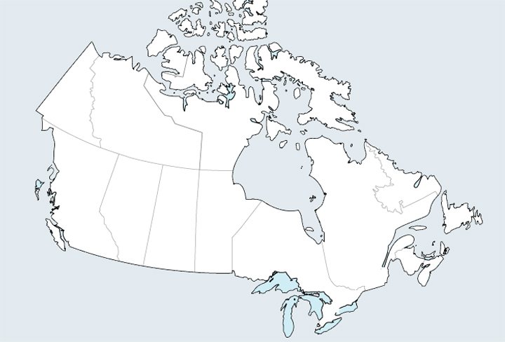
Canada is politically divided into 10 provinces – British Columbia, Alberta, Manitoba, Saskatchewan, Ontario, Quebec, New Brunswick, Nova Scotia, Newfoundland and Labrador, and Prince Edward Island – and 3 territories — the Yukon, Northwest Territories, and Nunavut. The country is framed by 3 oceans — the Pacific to the west, the Arctic to the north, and the Atlantic to the east. The border with the United States to the south, running predominantly along the 49° parallel, is the longest peaceful border in the world.
Facts of Interest
- Area: 9,984,670 sq. km (or 3,855,100 sq. mi.)
- Country with the second-largest area in the world (after Russia)
- 91% is land and the remainder fresh water
- 40% lies north of 60° N latitude
- 27% of Canada lies north of the tree line
- Length of coastline – world’s longest (202,080 km or 125,560 miles)
- Canada and the United States share the Great Lakes, the largest group of freshwater lakes in the world. Only Lake Michigan is entirely within the United States.